

Securing Your Ideal Spot on Direction Island, in the Cocos (Keeling) Islands
In 2017, Cossies Beach, in the Cocos (Keeling) Islands, was named the Best Beach in Australia. Named after Governor-General, Sir Peter Cosgrove, Cossies beach is on Direction Island, one of the 27 palm-fringed atolls that make up the Cocos (Keeling) Islands.
When visiting the Cocos (Keeling) Islands, a day trip to Direction Island is a must (see our guide How to Visit Direction Island, Voted Australia’s Best Beach, Cocos (Keeling) Islands, Australia).
And if you are keen to score one of the best picnic spots on DI, here is everything you need to know…
Arriving on Direction Island
The travel time from Home Island to Direction Island is around 25 minutes.
First step, if you don’t have too much gear with you, we would suggest you avoid leaving it in the designated area at the rear of the ferry, as it will definitely slow your disembarkation when the time comes. If you have stowed it here, retrieve it early (we would suggest during the leg from Home to Direction Islands) and wait with it on the rear deck of the ferry.
As the ferry approaches DI, savvy visitors will begin to mill about on the left hand side of the ferry’s rear deck, ready to disembark – don’t be shy, join them. This will ensure you are one of the first off the boat.
The view down the jetty as you disembark at Direction Island.
Once docked, bid adieu to your friendly crew and head down the jetty and on to the island. Whilst breathtaking in its beauty, resist the urge to stop and take photos here – you can come back shortly for those insta-worthy snaps. Now is the time to hustle.
While there is plenty of space for everyone on the island, different guests prioritise different aspects of DI’s appeal – some want to be near the best snorkelling, some want a particular stretch of beach (frankly, all of the long lagoon shore is stunning), others want to be near the barbecues, while others may value serenity and privacy.
Personally, we were keen to snorkel “The Rip” at the Island’s easternmost end, and preferred a quiet and private cabana away from the larger groups! For that we chose the easternmost of DI’s cabanas – number 7, and we found it was perfect for us.
To get to cabana 7, walk straight off the jetty towards the pagoda, then turn immediately right.

The first things you will see as you walk off the jetty are the Heritage Trail information sign and the pagoda which contains some very interesting World War II information. But, come back to it later, for now, focus on finding your perfect spot for the day…
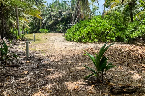
Walk eastwards along the Direction Island Heritage Trail through a grove of palm trees, and you will soon come to the first cabana, which has two tables and is close to the beach.

The view as you turn right off the jetty at Direction Island.

Cabana 1 in the foreground, to the right, with cabanas 2 and 3 in the distance.
A short distance further on, three cabanas with tables and seating will be within sight. They are popular among larger groups and tend to be a little noisier than the shelters further on. If that is up your alley, go for it, though expect to share the facilities here.
Cabanas 2 and 3 are large shelters near the brick barbecues, a set of toilets and the swimming pontoon. The first is decorated with yachting memorabilia, and is often used by school groups and large parties, and can be quite raucous. It has a large green water tank (not drinking water) and is where the island’s wi-fi antenna is located.

Cabana 2.

Cabana 3.
However, if you are one of the first off the ferry, and you prefer your peace and quiet, don’t wimp out and grab the first available, keep going…
Soon you will come to Cabana 4, which has a degree more privacy.

Cabana 4.
It may now seem that you have reached the end of the picnic grounds, but there are three more cabanas beyond through the forest, beyond the clearing.

Continue along the forest path to cabanas 5, 6 and 7.
The fifth cabana is a bit further on and is more secluded, and has its own firepit. It is near the second set of toilets.

Cabana 5.
Continuing on through the forest, beyond the end of the Heritage Trail and past the sign for the viewing platform, is cabana 6, a lovely location with two tables tucked into the overhanging palm trees.
The view of the trail after cabana 5.
If there is someone ahead of you going to nab cabana 7, don’t hesitate to set up camp here at cabana 6.

Cabana 6 is just after the sign to the Viewing Platform.

Apologies, we don’t have an image from the inland trail of the second last shelter (caban 6). It didn’t seem right taking a photo given the exploits of the occupants at the time ;) But this is what the second last shelter looks like from the beach side, it is clearly labelled with “Cocos HHH 1,400th Run”.
Once past cabana number 6, the viewing platform itself comes into view.

The viewing platform at the easternmost end of Direction Island.
But just before the viewing platform is the seventh and final of the cabanas, cabana 7, with just a single table and a glorious view out over the lagoon.
In front, large rocks close to shore provide a haven for small fish and occasional reef sharks venturing into the shallows.
We found this cabana perfect for its proximity to The Rip, for its leisurely snorkelling right in front, and for its quiet seclusion for beachside relaxing and decadent picnicking.

Cabana 7, the last as you head east, located just before the Viewing Platform

Cabana 7 is named “Marine Base” (only visible from the beach front) and contains basic surf life saving equipment (not to be used other than in an emergency).
Of course everyone is on DI to have fun, and to make the most of this idyllic location and unmissable opportunity. So if you are at some point asked to share your shelter (as we were later in the day) do please be courteous and accommodating.


